Tiddas Dam: Capacity, Water Level & Strategic Role in Morocco
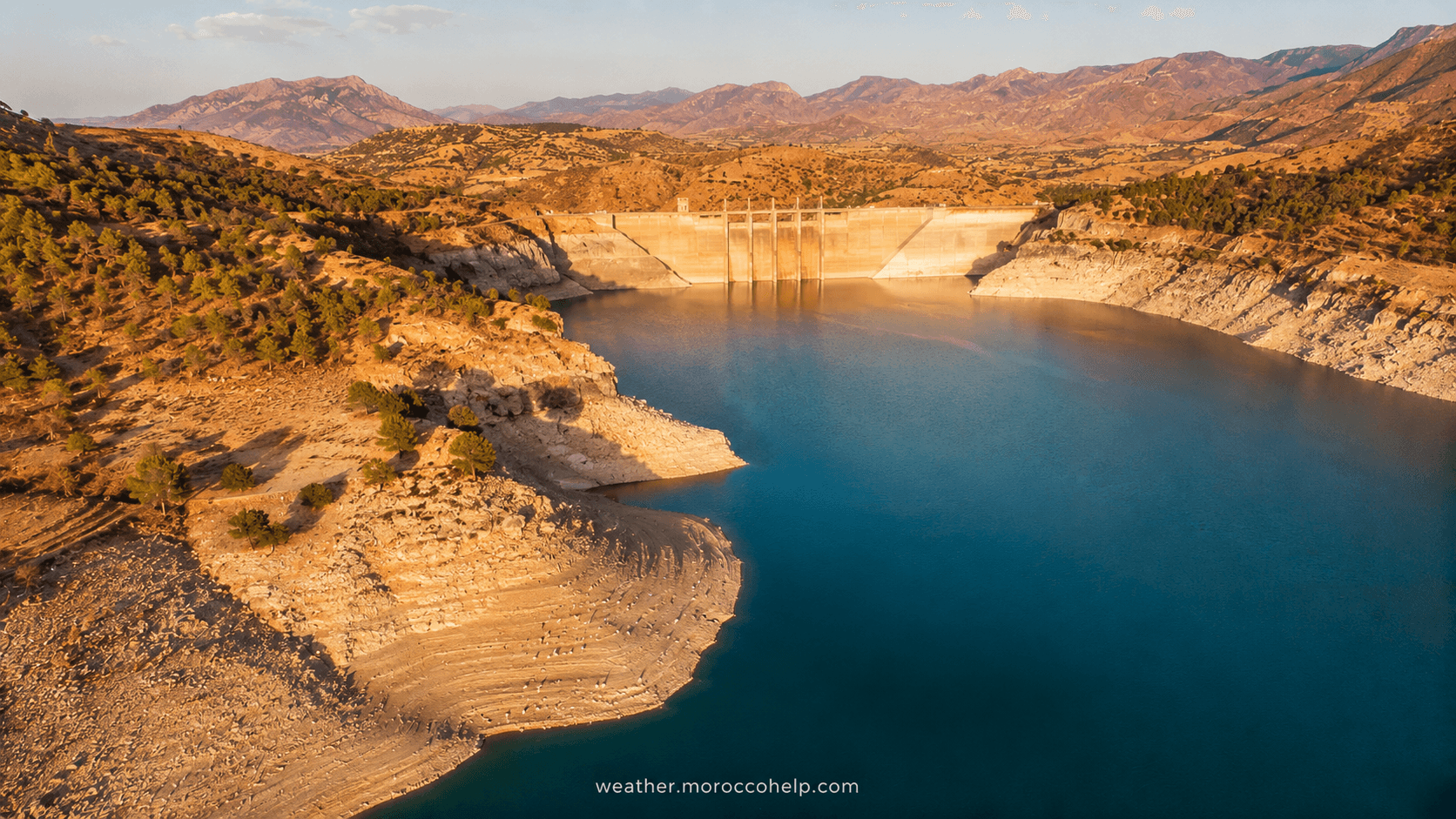
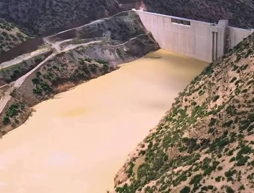
Tiddas Dam is a strategic 106-meter-high embankment located in Khemisset Province, about 70 km southwest of Rabat. Commissioned in 2022 after six years of construction by SGTM at a cost of 867 million Moroccan dirhams, it has a storage capacity of 507 million m³ and secures the drinking water supply for the Kenitra-Rabat-Casablanca corridor home to more than 8 million people.
Tiddas — from the Amazigh for "group of hills" — is a key link in King Mohammed VI's water policy. Built upstream of Sidi Mohammed Ben Abdellah Dam on the Bouregreg River, it regulates flows, irrigates 4,627 hectares, and protects the downstream valley from flooding.
Tiddas Dam Technical Specifications
| Specification | Value |
|---|---|
| Location | Khemisset Province, 70 km southwest of Rabat |
| River | Bouregreg |
| Watershed area | 2,170 km² |
| Dam type | Embankment |
| Height | 106 m |
| Storage capacity | 507 million m³ |
| Reservoir area | 15.57 km² |
| Normal retention level | 327 m NGM |
| Maximum water level | 332.4 m NGM |
| Year commissioned | 2022 |
| Construction duration | 6 years |
| Construction cost | 867 million MAD |
| Builder | SGTM |
| Irrigated area | 4,627 hectares (Béni Zoulit, Aït Zaghou, Aït Boumska) |
Capacity and Strategic Role
With 507 million m³, Tiddas is not Morocco's largest dam — far behind Al Wahda (3,522 Mm³) or Al Massira (2,760 Mm³) — but its strategic impact is massive for three reasons:
1. Securing drinking water for the Kenitra-Rabat-Casablanca corridor
The Kenitra-Rabat-Casablanca corridor is home to more than 8 million people and is Morocco's most dynamic drinking water consumption zone. Tiddas complements Sidi Mohammed Ben Abdellah Dam (SMBA, 631.5 Mm³) to meet growing demand.
2. Regulating Bouregreg floods
During heavy rainfall, Tiddas acts as a shock absorber: it temporarily stores excess Bouregreg inflows and then releases them progressively to SMBA. This function prevents destructive overflows like those that hit the Bouregreg plain in 2018, when SMBA exceeded 100% capacity.
3. Link in the Sebou-Bouregreg "water highway"
Tiddas is part of a wider regional hydraulic system, including the "water highway" Sebou-Bouregreg — a 66.7 km aqueduct that has already transported more than 700 million m³ of drinking water to Rabat and Casablanca since commissioning.
Current Water Level and Fill Rate
The water level at Tiddas Dam is continuously monitored by Moroccan hydraulic authorities and updated regularly on our dashboard. Current fill is around 60%, or about 304 Mm³ stored out of a 507 Mm³ capacity.
Historical fill rate since commissioning:
| Year | Fill rate |
|---|---|
| 2022 | 5% |
| 2023 | 15% |
| 2024 | 25% |
| 2025 | 44% |
| 2026 | 60% (current) |
A dam's fill rate varies widely from year to year based on rainfall. Always check the live data before any water-related decision or trip planning.
Watershed and Irrigation
Tiddas Dam drains a watershed of 2,170 km² fed by the Bouregreg River. The reservoir irrigates 4,627 hectares across three agricultural perimeters:
- Béni Zoulit — arboriculture (olive trees, almond trees)
- Aït Zaghou — vegetable crops
- Aït Boumska — arboriculture and fodder
This local agriculture depends heavily on the dam's releases, especially during summer water stress. The Khemisset region is one of the zones where irrigation support policy has been strengthened since 2022.
History and Construction
Tiddas Dam was commissioned in 2022, marking the completion of a six-year construction project led by SGTM (Société Générale des Travaux du Maroc). The total cost reached 867 million Moroccan dirhams, financed under the national water security policy.
Tiddas is part of the dam acceleration policy launched under King Mohammed VI. More than 60 dams have been built in 20 years, bringing the national park to nearly 160 large dams and a total capacity of 17.5 billion m³.
The name "Tiddas" comes from Amazigh and means "group of hills", referring to the hills surrounding the reservoir. The site choice, upstream of Sidi Mohammed Ben Abdellah Dam, was driven by favorable topography and the potential to optimize regional storage.
Comparison with Other Bouregreg Basin Dams
Tiddas shares the Bouregreg basin with four other major dams. Here is their hierarchy by capacity:
| Rank | Dam | Capacity (Mm³) | Current rate | Primary role |
|---|---|---|---|---|
| 1 | Sidi Mohammed Ben Abdellah | 631.5 | ~39% | Drinking water Rabat-Salé |
| 2 | Tiddas | 507 | ~60% | Regulation, irrigation |
| 3 | El Maleh | 640 | ~25% | Irrigation Mohammedia |
| 4 | Tamesna | 56 | ~34% | Irrigation Casablanca-Settat |
To compare Tiddas's level with every dam in Morocco, check our dam water levels dashboard.
FAQ: Your Questions about Tiddas Dam
What is the capacity of Tiddas Dam?
Tiddas Dam has a total capacity of 507 million cubic meters (Mm³), making it one of Morocco's major dams. It ranks 2nd in the Bouregreg basin behind Sidi Mohammed Ben Abdellah.
Where is Tiddas Dam located?
Tiddas Dam is located in Khemisset Province, Rabat-Salé-Kénitra region, about 70 km southwest of Rabat near the town of Tiflet. It is built on the Bouregreg River.
When was Tiddas Dam built?
Tiddas Dam was commissioned in 2022 after six years of construction by SGTM (Société Générale des Travaux du Maroc). The total project cost 867 million Moroccan dirhams.
What is the current water level at Tiddas Dam?
Tiddas Dam's current fill rate is around 60%, meaning approximately 304 million m³ stored out of a 507 Mm³ capacity. Levels fluctuate with seasonal rainfall; see the dedicated page for real-time data.
What is Tiddas Dam used for?
Tiddas Dam has three main functions: (1) securing drinking water supply for the Kenitra-Rabat-Casablanca corridor, (2) regulating Bouregreg floods to protect downstream areas, and (3) irrigating 4,627 hectares of farmland.
Which river feeds Tiddas Dam?
Tiddas Dam is fed by the Bouregreg River, one of the main watercourses of western Morocco. Its watershed covers 2,170 km². The Bouregreg flows north into the Atlantic Ocean between Rabat and Salé.
Sources
- Médias24 (May 2025) — In-depth article on Tiddas Dam and its strategic role
- sygeo.ma — Tiddas Dam technical data sheet
- Le360 — Tiddas Dam construction cost (867 MDH)
- SGTM — Construction company
- Direction Générale de l'Eau — Official fill rate data